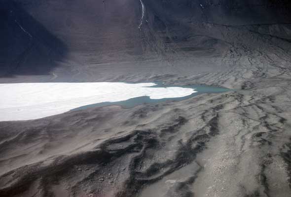
Landsat image of the McMurdo Sound area. (adapted from The Roof at the Bottom of the World)
As the ship Discovery sailed back from a voyage along the Great Barrier (Ross Ice Shelf), the commander of the expedition, Robert Falcon Scott, was eager to find a suitable cove to moor the ship for the winter. On February 8, 1903, skirting along the west side of Mt. Erebus (the active shield volcano on Ross Island,) Discovery rounded the tip of the long peninsula and found a small, protected bay backed by fast ice and shoreline. After weighing the pros and cons, Scott recorded in his journal, “On the whole to-night I feel like staying where we are.” In a saddle just inland of the point, the party constructed a large, square hut for storage, and two smaller ones for geomagnetic observations. From its mooring at Hut Point, Discovery commanded a view of Winter Quarters Bay encircled as it was by volcanic landforms, the most prominent being Observation Hill.

This image looks across Winter Quarters Bay from Hut Point, with Discovery moored at the point and the three huts constructed by the expedition in the foreground. Observation Hill is immediately out of the photo on the right. (Photo from Scott's book, The Voyage of the Discovery, 1905.)
What Scott did not know at the time was that the breakout of ice during the 1902-03 austral summer was particularly deep into McMurdo Sound. After being fast for two winters and nearly so for a third, he came to realize. Subsequently, Shackleton was stopped by fast ice in 1908 at Cape Royds, 20 miles north of Winter Quarters Bay, and Scott in 1911 at Cape Evans about eight miles south of Cape Royds.
At the start of the International Geophysical Year (IGY, 1957-58,) the US chose Winter Quarters Bay as the location of its main center of operations, naming it McMurdo Station. The station is situated at a unique and strategic site. The slip behind Hut Point has water deep enough to accommodate large supply ships and tankers. In the early summer the ice out from the station is hard and smooth from the previous winter’s freeze and allows the landing of wheeled aircraft. Whereas about five miles to the south and up a gentle rise one comes to the Ross Ice Shelf, where a prepared runway allows aircraft landings all season.
The construction of McMurdo Station was the responsibility of the Navy’s newly established Task Force 43 (nicknamed Operation Deep Freeze), under the command of Adm. George Dufek. Because the hillsides around Winter Quarters Bay are fairly steeply inclined, the first task of the Seabees was to bulldoze down from the hillsides any loose volcanic gravel they could find and with it built terraces where buildings could be constructed. The station evolved quickly. By 1970 when I first saw McMurdo, all of the principal buildings were in place, and most of these have not changed their footprint since then. All of the pipes for water and sewer are above ground and must be insulated and wrapped in heat tape. The hospital, the garages, the firehouse, the helicopter hangar, the command center, the field staging buildings, the NSF chalet, all of these have been there from early years. The dining area was redesigned in the 1990’s, and the outside of the building was painted blue over the old tan, but the store and rec rooms remained pretty much the same.

Sketch of changes to the terrain around Winter Quarters Bay between 1956 and 1993. The high landform at the right edge of the image is Observation Hill. Hut Point is in the left foreground. (Source: Antarctic Journal of the U.S., v. 28, no. 2, 1993.)
What has changed is the sleeping quarters. In 1970 most everyone slept in group quarters with toilets and showers down the hall. By the 1980’s a series of buildings were constructed to house the growing population of McMurdo. Since then the standard is a pair of shared bedrooms sharing a common sink, shower, and toilet. A new science building was opened in November 1991, providing much needed space for science projects at the base. The cargo yards and the yard for recycling seem only to get bigger every year.
The two views of McMurdo Station that follow were shot in January 1983 and January 2011. One notable difference is the buildings that housed the nuclear power plant half way up on the side of Observation Hill in the lower left of the 1983 photo are gone in the 2011 photo. When it was shut down in October 1972, the plant had a record of more than a decade of continuous service. Since then, McMurdo has been powered by petroleum, and of late by supplementary wind power. Note the presence of fuel tanks up the hill on the far side of McMurdo in the 1983 photo, and their removal by 2011, along with the addition of several new tanks in the foreground of the photo.

McMurdo Station from Observation Hill, January, 1983

McMurdo Station from Observation Hill, January, 2011.
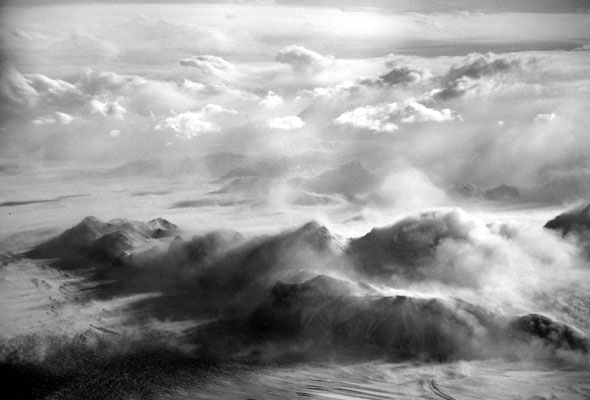
Gallery: Crevasses
Crevasses are fractures that open in moving glacier ice. At slow rates of movement glaciers flow as ductile (or plastic) solids, moving smoothly down their gradient; however, if the rate of movement is too fast, the ice will behave as a brittle solid and crack. Each time the ice cracks, the amount of actual displacement is a millimeter or so, but compound these fractures over time and very wide openings may result. Typically, as a crevasse opens windblown snow sifts into the opening crack and lodges there. As the crevasse widens, the continuous addition of snow creates a bridge across a crevasse. A great variety of crevasse patterns are possible depending on local conditions, as demonstrated in this week’s gallery. All of these images are taken in the vicinity of Byrd Glacier.